Otatomarinuma Pond
Rishirifuji Town ・ オタトマリ沼
NowOtatomarinuma Pond today3D view built from GSI elevation data and recent aerial imagery. Use the buttons at top left to view from the north, east, south or west, or drag to rotate. On phones, move two fingers up or down to tilt, and pinch to zoom.
Loading the 3D view
GSI Tiles (elevation tiles, seamless aerial photos), processed by this site.Data sources: Landsat8画像(GSI,TSIC,GEO Grid/AIST), Landsat8画像(courtesy of the U.S. Geological Survey), 海底地形(GEBCO)。
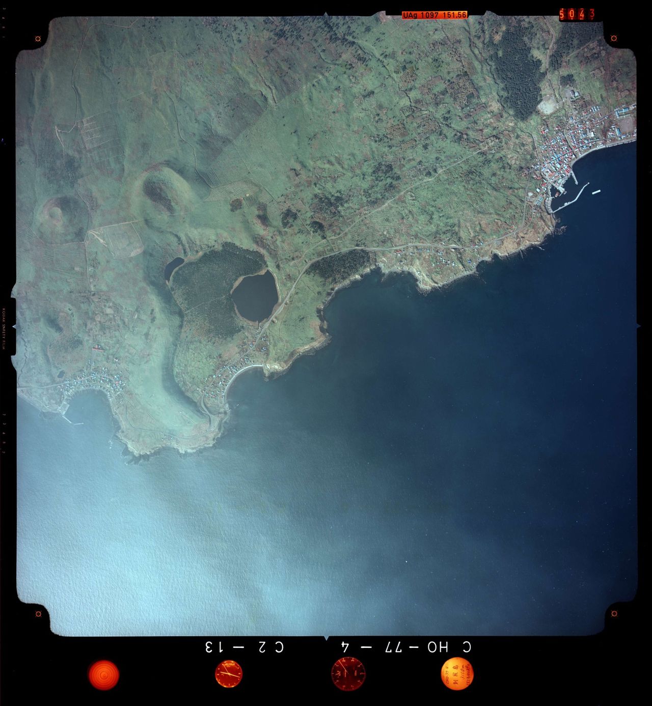
1977Otatomarinuma Pond in 1977Aerial photo taken by the Geospatial Information Authority of Japan, shown with the film edge and instruments intact.
About Otatomarinuma Pond
A pond about 1 km around in southeastern Rishiri Island, the largest lake on the island. A walking path circles it, with Mt. Rishiri reflected on the water. In the 1991 survey it was dystrophic, with pond lilies and pygmy water lilies, and crucian carp and loach.
Sources: Ministry of the Environment, Rishiri-Rebun-Sarobetsu National Park, Environment Agency of Japan, Lake Survey Report (1993), Environment Agency of Japan, Lake Survey Report: Data Appendix (1993) (sources in Japanese)
Lake data
- Area
- 0.08 km²#86 in Hokkaido
- Average depth
- 0.9 m
- Surface elevation
- 5 m
- Transparency
- 1 m#43 in Hokkaidoas of the 1991 survey
- Origin
- Lagoon-origin lake
- Lake type
- Dystrophic
- Fresh or brackish
- Freshwater
- Freezing
- Freezes in winter
- Natural park
- Rishiri-Rebun-Sarobetsu National Park
- Lake number
- 0130number in the national lake survey
Sources: Environment Agency of Japan, 4th National Survey on the Natural Environment: Lake Survey Report (1993). Area and depth use newer figures from the Geospatial Information Authority of Japan where available. Origin, lake type, transparency, freezing and unmodified status are as of the 1991 survey.
Themes that include Otatomarinuma Pond
Nearby lakes
Nearby mountains
Nearby roadside stations
- Michi-no-Eki TeshioTeshio Town45 km
- Michi-no-Eki WakkanaiWakkanai City45 km
- Michi-no-Eki Enbetsu FujimiEnbetsu Town60 km
Straight-line distances.